 |
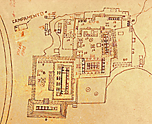
Detail of East Group from 1968 INAH map; Palace toward upper-right.
Jan. 2002 |
|
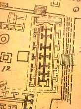 |
Detail of Palace Plaza from 1968 INAH map; standing portions colored dark.
Jan. 2002 |
|
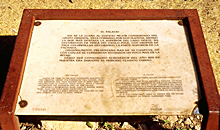 |
Official INAH sign in front of Palace.
Jan. 2001 |
|
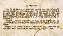 |
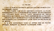
Detail of INAH sign: Spanish description.
Jan. 2003 |
|
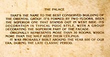 |
Detail of INAH sign: English description.
Jan. 2001 |
|
 |
Detail of INAH sign: French description.
Jan. 2003 |
|
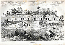 |
1843. "Kabah. Front of Casa No. 2." Facade of 2nd level well preserved; some remains of roofcomb and central staircase; 1st level largely collapsed.
Scanned from Stephens and Catherwood, Incidents of Travel
in Yucatan, 1843, Vol. I, facing p. 397; closely based on Frederick Catherwood’s 1841-42
on-site drawing. |
|
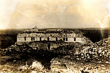 |
1930. Kabah, Front facade; relatively unchanged over previous 87 years.
Photograph by Dan Leyrer as member of Blom/Tulane expedition, 1930. Scanned from 35mm slide of the original photograph (M.31.8.92). Reproduced with permission of the Middle American Research Institute (MARI), Tulane University. |
|
 |
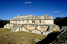
2003. Front (west) facade, partly
reconstructed; symmetrical facade with central staircase, two doorways
with single columns.
Jan. 2003 (24mm lens)
|
|
 |
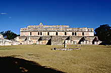
Front facade and south end,
showing restored central staircase and partially restored
ground level rooms.
Jan. 2003 (24mm lens) |
|
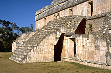 |
Partially restored central
staircase with half-vault underpass ("flying staircase").
Jan. 2003 (24mm lens) |
|
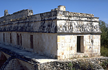 |
South end of upper level,
reconstructed, with inclined frieze.
Jan. 2001 |
|