 |
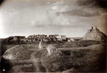
1930. Photograph taken before any liberation, consolidation, restoration, or reconstruction (cf. other images on this page).
Photograph by Dan Leyrer as member of Blom/Tulane expedition, 1930. Scanned from 35mm slide of the original photograph (M.31.4.330). Reproduced with permission of the Middle American Research Institute (MARI), Tulane University. |
|
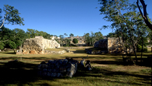 |
2003. Looking north through center
of ballcourt, lined up approximately with the Nunnery's vaulted
entryway in distance.
photo Jan. 2003 (24mm lens) |
|
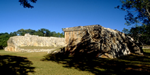 |
Ballcourt studied, liberated, consolidated, reintegrated, restored, and published: 1977 and 1978.
photo Jan. 2003 (24mm lens) |
|
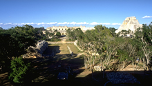 |
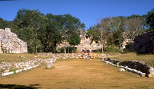
Looking north from Great
Platform of Governor's Palace; ballcourt was lined up approximately
with a staircase up to the Great Platform (immediately below
in foreground) and with the Nunnery's vaulted entryway.
photo Jan. 2003 (24mm lens) |
|
 |
Central
alley of ballcourt, leveled as playing court.
photo Jan. 2002 |
|
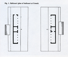 |
1995. "Ballcourt (plan of ballcourt at Uxmal)."
Scanned from George F. Andrews, Pyramids and Palace, Monsters and Masks; Vol. 1, Architecture of the Puuc Regions and the Northern Plains Area, 1995 (p. 213). Reproduced with permission of Labyrinthos publishers. |
|
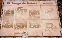 |
Official INAH plaque on ground in front of ballcourt.
photo Jan. 2003 |
|
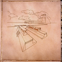 |
Detail of plaque at left;
showing 3-d diagram of Ballcourt, reconstructed to show probable
stairs and superstructures.
photo Jan. 2003 |
|
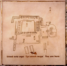 |
Detail of plaque at far-left;
groundplan of Nunnery Quadrangle, Pyramid of the Magician,
ballcourt, and other structures in area; arrow indicates location
of Ballcourt.
photo Jan. 2003 |
|
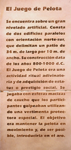 |
Description in Spanish.
photo Jan. 2003 |
|
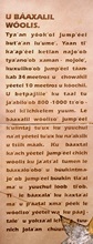 |
Description in Yucatec Mayan.
photo Jan. 2003 |
|
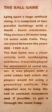 |
Description in English.
photo Jan. 2003 |
|